

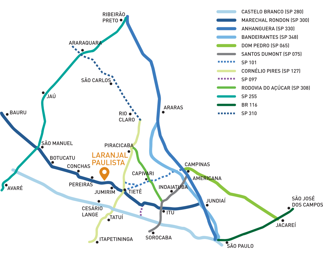
Distance
Tietê
18 km (11 mi)
Tatuí
50 km (31 mi)
Piracicaba
62 km (38 mi)
Botucatu
70 km (43 mi)
Itu
70 km (43 mi)
Sorocaba
76 km (47 mi)
Campinas
105 km (65 mi)
São Paulo
173 km (107 mi)
• Founding date: 10 de outubro.
• Fouding year: 1917.
• Inhabitants: 28.240.
• Motto: Serviendo patriae rex (Serving the homeland I'm king).
• Demonym: Laranjalense.
• Main Access Road: Rodovia Marechal Rondon.
• Location: Located in the São Paulo peripheral depression between the Atlantic Plateau - capital region - and the Western Plateau - Botucatu region:
• Hydrography: Tietê and Sorocaba rivers, plus six streams and six creeks.
• Climatology: Average annual temperature 23, 27°C (73, 80°F)
• Area: 386,763 km2.
• Rainfall: 1.257,0 mm.
• Type of soil: Polyculture and in some parts geological conditions allow the exploration of mineral resources such as sand, clay, gravel, limestone used in civil construction.

USEFUL PHONE NUMBERS
City Hall
(15) 3283-8300
Municipal Guard
(15) 3283-1007
Police Station
(15) 3283-1611
Fire Department
193
Santa Casa Hospital
(15) 3383-9191
Health Center
(15) 3283-1117
Child Protective Services
(15) 3283-4500
Municipal Library
(15) 3283-1880
Bus Terminal ou Bus Station
(15) 3283-3799
To go to Laranjal Paulista, leaving São Paulo, access the SP-280 (Rodovia Castello Branco) until exit 99-A, the SP-097 (Rodovia Dr. Antônio Pires de Almeida) and the SP-300 (Rodovia Marechal Rondon).